| このサイトについて |
|
|
地図上の半径:円を描くための簡単なツール
価格: 無料
App Store評価:
(評価数: 1)
■ 概要
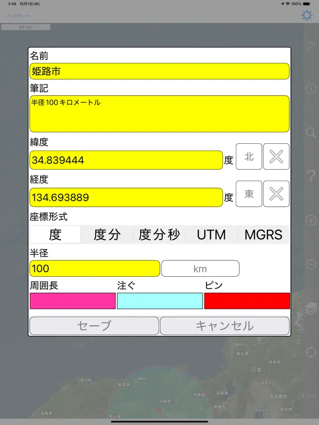
地図上に簡単に半径を作成し、どのブラウザでも表示できる電子メールまたはテキストメッセージで半径を示すURLを共有します。 各半径のプロパティ: - 中心座標 - 半径 - 塗りつぶしの色と不透明度 - 周囲の色と不透明度 - 名前 - メモ(オプション) 座標形式には、次のものがあります。 - 度 - 度、分 - 度、分、秒 - UTM(ユニバーサル横メルカトル) - MGRS(ミリタリーグリッド参照システム) 距離の単位には、次のものが含まれます。 - キロ - マイル - 海里 - メートル - ヤード - フィート 衛星地図を読み込むには、インターネット接続が必要です。 使用されるデータムはWGS-84です。 詳しくはサポートページをご覧ください。 English: Easily make a radius on a map and share a url showing the radius via email or text message that can be viewed with any browser. Properties for each radius: - Center coordinate - Radius - Fill color and opacity - Perimeter color and opacity - Name - Notes (optional) Coordinate formats include: - Degrees - Degrees, Minutes - Degrees, Minutes, Seconds - UTM (Universal Transverse Mercator) - MGRS (Military Grid Reference System) Distance units include: - Kilometers - Miles - Nautical miles - Meters - Yards - Feet Loading satellite maps requires an internet connection. Datum used is WGS-84. Please visit the support page for more details. [ 一覧に戻る ] ※タイトルロゴをタップしても戻れます。 |
|
Copyright (C) 2011 AppleRank. All Rights Reserved.
|